Day Trips from Las Vegas: The Best Escapes from the Strip
18 minutes
Las Vegas is excellent at keeping you inside it. The casinos have no clocks, no windows and no particular interest in reminding you that the outside world exists. The Strip is designed as a closed system, a loop of spectacle that feeds back into itself, and a surprising number of visitors complete an entire visit to Nevada without once breathing desert air or seeing a horizon that does not have a hotel on it.
This is a shame, because the landscape within a day’s drive of Las Vegas is among the most varied and dramatic in North America. Red sandstone canyons, the lowest point on the continent, a nuclear ghost highway, the engineering marvel that tamed the Colorado River, one of the great national parks in the United States: all of it within reach, most of it within an hour or two. The distances below are from the Strip; add time for traffic on the I-15 northbound, which can be significant on weekend mornings. Admission prices were correct at time of writing; the usual caveats apply. Bring water, more than you think you need, for anything involving the desert.
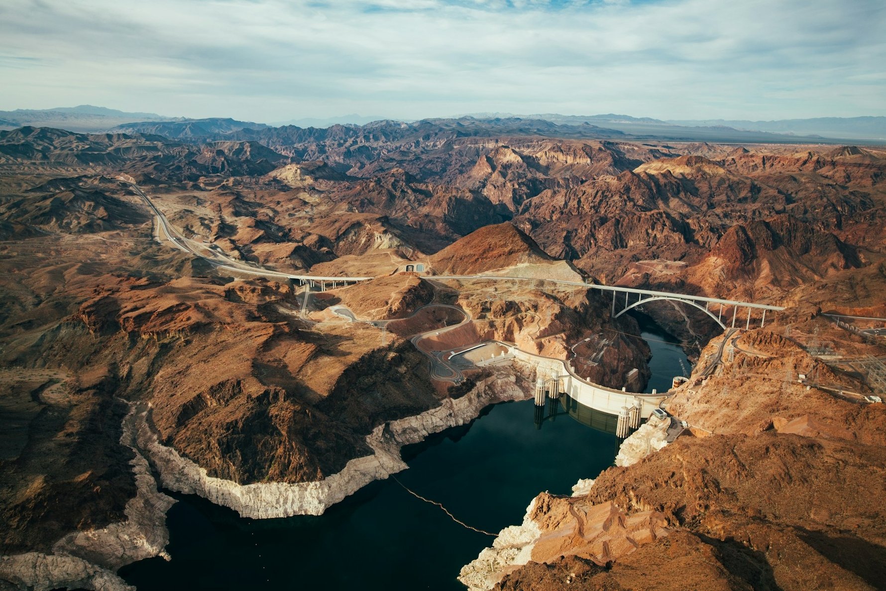
The Hoover Dam is about 50 kilometres southeast of Las Vegas on US Route 93, and the drive takes roughly 45 minutes. It was completed in 1936, is 221 metres tall, holds back 35 cubic kilometres of water in Lake Mead, and powers much of Nevada, Arizona and California. It is also, unexpectedly, beautiful: an Art Deco structure of such self-assurance that it commissioned sculptural programmes and terrazzo floors before anyone suggested this was perhaps excessive for a civil engineering project. The two winged figures at the base, cast in bronze by sculptor Oskar Hansen in 1939 and standing nearly ten metres tall, are among the more remarkable public artworks in the American West, and most people walk past them without stopping. Stop.
The visitor centre admission covers the observation deck and exhibits on the dam’s construction; the powerplant tour takes you inside the structure to the generator room, 150 metres below the crest of the dam, where the turbines that have been running since the 1930s are still running. It is worth the upgrade. The Mike O’Callaghan–Pat Tillman Memorial Bridge, completed in 2010, offers a pedestrian walkway 270 metres above the Colorado River with the dam and canyon below it: one of the stranger views available on a day trip from anywhere.
On the way to the dam, Boulder City is worth at least a slow drive and ideally a stop for lunch. It was built in 1931 by the federal government specifically to house the dam workers: a planned town of tree-lined streets, parks and grid blocks, designed by Dutch-born architect Saco Rienk DeBoer as a model community. The federal government banned gambling and alcohol when the town was founded; the alcohol ban was eventually lifted, but the gambling prohibition remains. Boulder City is consequently the only city in Nevada without a casino, which gives its historic downtown a quiet, slightly defiant character that is in every way the opposite of Las Vegas 50 kilometres up the road.
Distance from Las Vegas: About 50km; 45 minutes on US-93 South.
Best time to go: Weekday mornings. The dam is significantly less crowded before 10am and after 3pm. Avoid summer midday – the concrete amplifies the heat considerably.
What to budget: Visitor centre admission around $15; powerplant tour around $30–40. Parking costs extra. Check usbr.gov/lc/hooverdam for current prices before visiting.
Good to know: Bags are screened at the dam; large vehicles are subject to inspection. The trip to the dam, Boulder City and a lunch stop makes a comfortable half-day, leaving the afternoon free for something else.
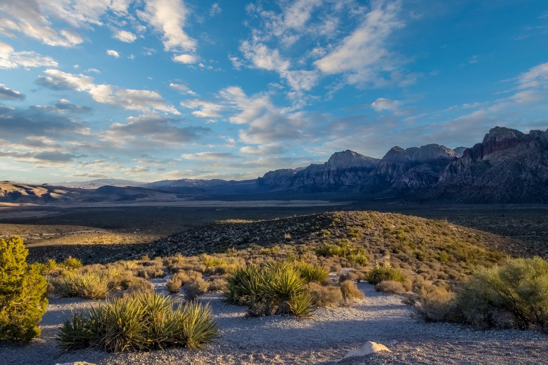
Thirty kilometres west of the Strip on State Route 159, the Mojave reasserts itself. Red Rock Canyon National Conservation Area is 46,000 acres of Aztec Sandstone, the same material as the formations at Zion and Bryce Canyon, layered in reds and creams and formed from ancient sand dunes 180 million years ago. The 13-mile scenic drive loops through the escarpment with pull-outs and short trail access throughout; the hiking options range from a 20-minute walk at Calico Hills to full-day routes in the canyon system.
The contrast with Las Vegas is immediate and complete. There are no buildings, no neon, no noise beyond wind and the occasional distant highway. The geology is doing things that are difficult to describe and easy to photograph badly; the reality is better than the pictures. The park is open year-round from sunrise to sunset; between October and May, timed entry reservations are required for the scenic drive between 8am and 5pm, bookable in advance at recreation.gov. Outside those hours the gate is open without a reservation. In summer the park is best visited before 8am; by 10am the temperature in the canyon can make hiking inadvisable for anyone who did not bring enough water, which is most people.
Distance from Las Vegas: About 30km; 30–40 minutes on W Charleston Boulevard (State Route 159).
Best time to go: Spring and autumn for the most comfortable temperatures; early mornings year-round. Avoid summer afternoons entirely.
What to budget: $20 per vehicle for the scenic drive; $5 per pedestrian. The America the Beautiful annual pass ($80) is valid here and at every other national park on this list.
Good to know: The visitor centre has trail maps, condition updates and water. There is no water on the trails. Red Rock combines naturally with a late afternoon visit to the Springs Preserve back in the city.
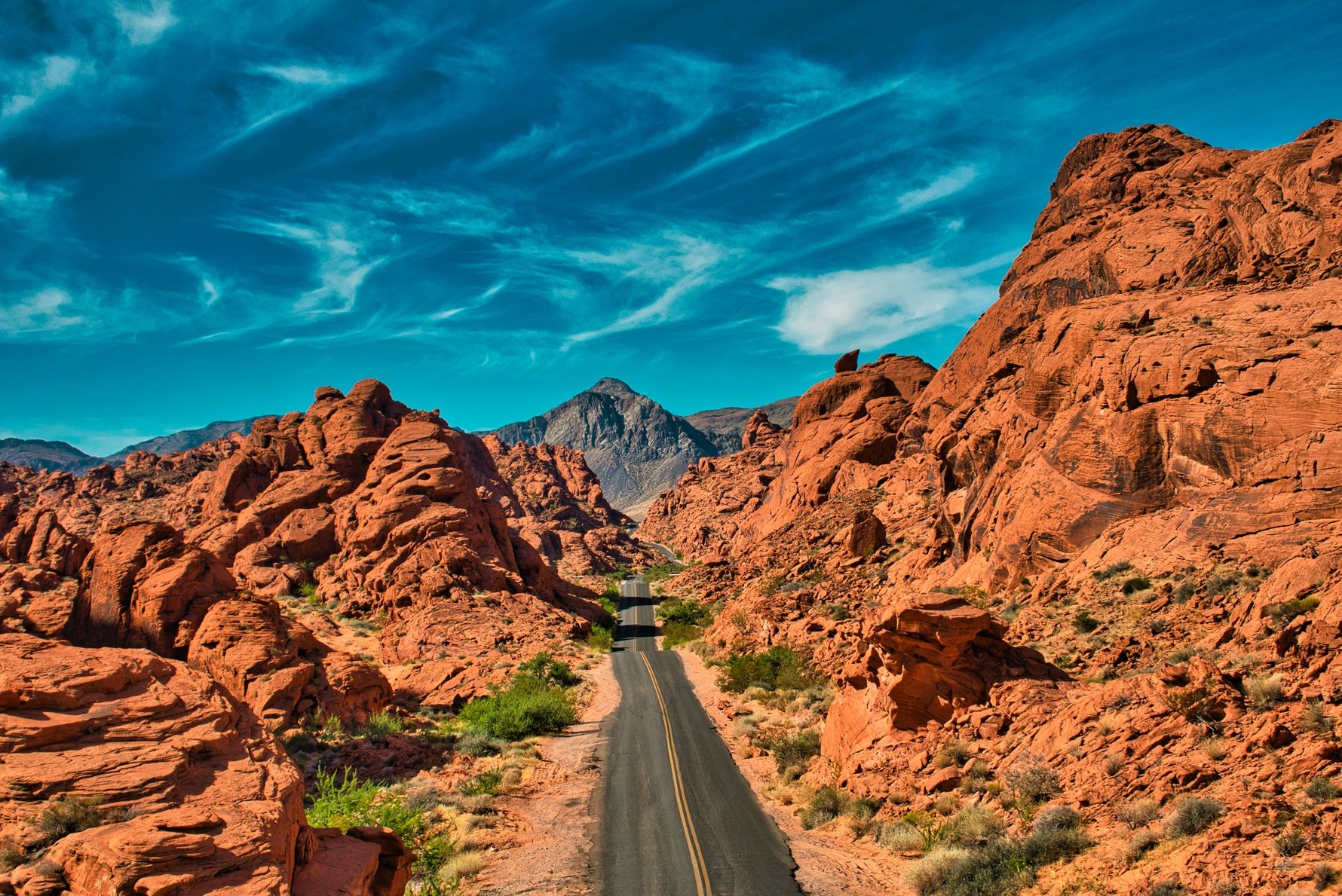
Nevada’s oldest and largest state park sits about 80 kilometres northeast of the Strip and looks, on arrival, like the surface of another planet. Valley of Fire State Park covers 46,000 acres of ancient red sandstone, the formations named for the way they appear to burn on clear mornings and evenings when the light hits them at an angle. It is less visited than Red Rock Canyon, more remote in character, and – many people who have seen both would argue – more spectacular.
The formations include white sandstone domes, slot canyons, Ancestral Puebloan petroglyphs on Atlatl Rock (visible from the boardwalk without hiking), petrified logs, and the erosion formations known as the Beehives and the Elephant Rock. The Fire Wave, a rippled sandstone formation of swirling red and white stripes, is the most photographed spot in the park and accessible via a 2.4-kilometre return walk from the car park on the northern loop road. The White Domes Trail, a 2.5-kilometre loop through a narrow slot canyon, is the best single hike if you only have time for one. The drive through the park itself, even without stopping to hike, is worth the journey. Summer temperatures regularly exceed 43 degrees Celsius; the park’s own guidance recommends avoiding it between June and August unless you are there before 8am and carrying serious quantities of water.
Distance from Las Vegas: About 80km; roughly one hour on I-15 North to Highway 169 East.
Best time to go: October through April. Sunrise and sunset for the most dramatic light on the formations.
What to budget: $15 per vehicle for out-of-state visitors; $10 for Nevada residents. No reservation required for day visits.
Good to know: Valley of Fire and Hoover Dam are often combined as a full day by taking the Lake Mead Scenic Drive between them – a 96-kilometre route along the north shore of the reservoir that links the two parks without returning to Las Vegas.
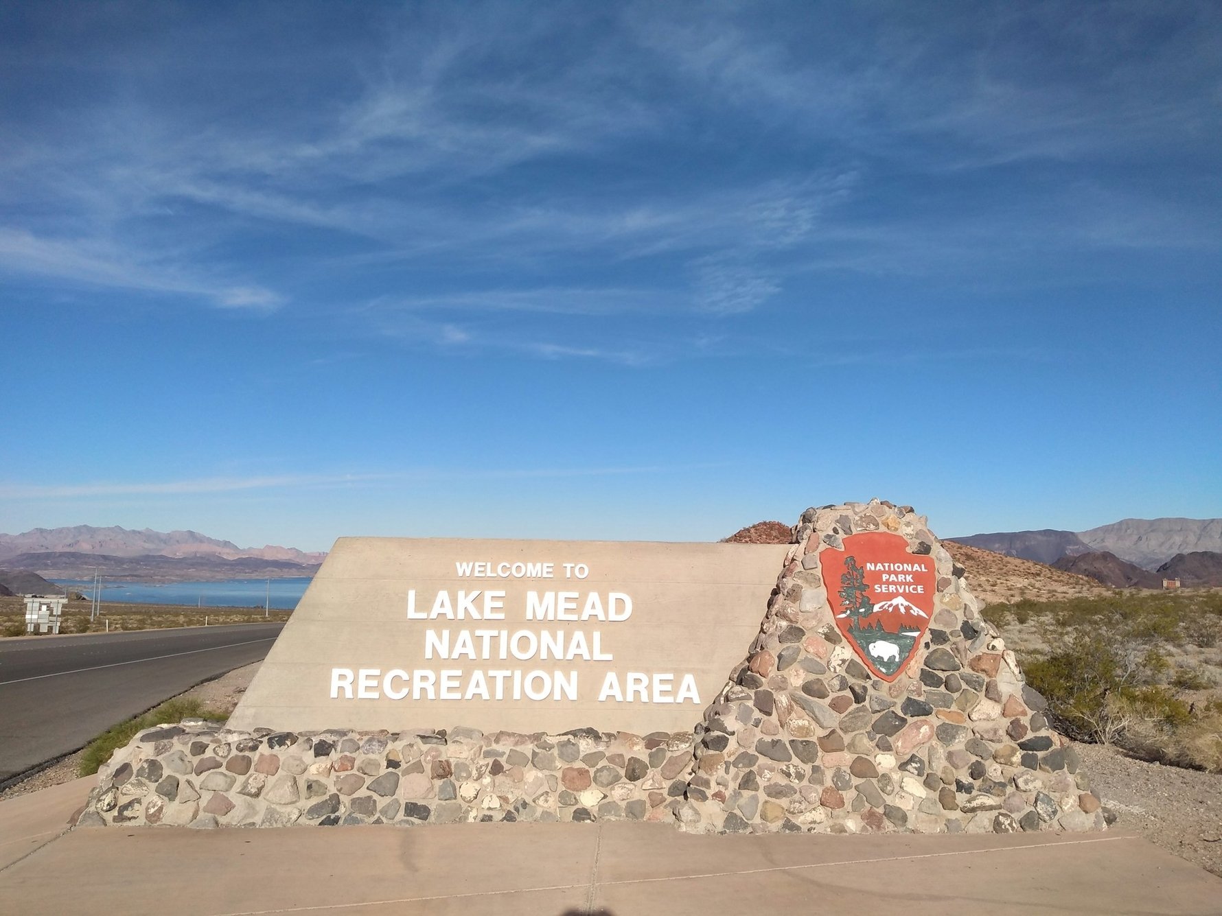
Lake Mead, the reservoir created by Hoover Dam, is the largest in the United States by volume when full. It has not been full for some time, and given the trends of climate change, most likely won't be for some time to come, if ever. The Colorado River compact of 1922 allocated more water than the river actually contains – a fact that was not widely confronted until the 21st-century drought made it impossible to ignore – and Lake Mead has been declining for decades as a result. In July 2022 it reached its lowest level since the 1930s, exposing lake bed that had been underwater for nearly 90 years: sunken boats, a Second World War–era Higgins landing craft, human remains in barrels (which, given the lake’s proximity to Las Vegas, prompted the kind of speculation that Las Vegas inspires), and the ruins of St. Thomas, a small Mormon settlement that was flooded in 1938 when the lake filled and has been emerging and submerging as water levels fluctuate ever since. Current projections suggest the lake will fall to new record lows again in 2027.
This is all genuinely interesting, and the Lake Mead National Recreation Area is still worth a day trip on its own terms. The Northshore Road along the Nevada side of the reservoir passes through scenery of considerable quality; Boulder Beach is the most popular swimming and boating area; the visitor centre at Alan Bible is well worth 30 minutes. The context of the drought and what it represents about water management in the American West adds a layer of meaning that straightforward natural beauty rarely provides on its own.
Distance from Las Vegas: The main visitor centre is about 40km from the Strip; 30 minutes on US-93 South.
Best time to go: Spring and autumn. Summer is very hot; winter is pleasant but some facilities have reduced hours.
What to budget: $25 per vehicle for the national recreation area (valid for seven days). The America the Beautiful pass is accepted.
Good to know: St. Thomas is accessible via a short hike from a car park near Overton Beach on the north shore. The ruins visible depend on the current water level; check the NPS site for current conditions before making a special trip.
Grand Canyon West
The Grand Canyon needs a caveat before anything else. The main park – the South Rim, the National Park Service visitor facilities, the full scale of one of the great natural wonders of the world – is approximately four and a half hours from Las Vegas. It is not a day trip. It is a proper journey requiring either an early start and a late return or, more sensibly, an overnight stop.
Grand Canyon West, on the other hand, is about two hours away, on the Hualapai Nation’s land on the western end of the canyon. It is a genuine Grand Canyon experience – the canyon is the canyon, the views are extraordinary, and the scale of the thing is not diminished by the approach – but it is a commercially operated attraction on sovereign tribal land rather than a national park, with the corresponding structure. The Skywalk, a glass-floored horseshoe walkway extending beyond the rim 1,200 metres above the canyon floor, is the headline attraction: you cannot buy a ticket for it in isolation; access requires the All-Access Pass, which covers shuttle transport between the viewpoints, cultural performances and the Guano Point overlook as well as the Skywalk itself. Guano Point, the westernmost viewpoint reachable by shuttle, is widely considered the best view on the western rim and is worth more of your time than the Skywalk. The canyon from Guano Point has depth and scale that the glass bridge, for all its engineering novelty, does not improve upon.
Distance from Las Vegas: About 190km; roughly two hours on US-93 South to Pierce Ferry Road.
Best time to go: Spring and autumn. Avoid summer unless you start before 7am; the western rim has limited shade and the heat is serious.
What to budget: The All-Access Pass is around $99 per adult; this includes the Skywalk, shuttle access to all viewpoints and cultural activities. Check grandcanyonwest.com for current pricing as it changes periodically.
Good to know: Personal cameras and phones are not permitted on the Skywalk itself; official photos are available for purchase at the exit. If the Skywalk is not the point for you, the general admission without it is considerably cheaper and the canyon views are identical.
Zion National Park
Zion National Park is 160 kilometres north of Las Vegas in southern Utah, approximately two and a half hours on I-15 North. The honest position is that it sits at the outer edge of a reasonable day trip: you will spend five hours driving for a three to four hour park visit, and the park itself warrants considerably more than that. That said, the drive through the Virgin River Gorge on the I-15 is spectacular in its own right – the interstate cuts through 47 kilometres of ancient sandstone canyon – and Zion’s main canyon, with its sheer red walls rising 600 metres above the Virgin River, delivers something that even a brief visit cannot diminish.
The free park shuttle runs the length of Zion Canyon Scenic Drive during the main season, stopping at the major trailheads. The Riverside Walk at the end of the road is the flattest and most accessible trail, following the river to the entrance of the Narrows; the Emerald Pools trails offer waterfalls and hanging gardens within an easy hour from the shuttle. Angels Landing, the iconic ridge walk with chains above a 360-metre drop, requires a separate permit through a lottery system and is not something to approach casually. The town of Springdale, directly outside the park’s south entrance, has enough restaurants and cafes to make the logistics of a day trip manageable. For anyone who can spare an extra day, Zion warrants it: stay in Springdale, do the park properly, and continue to Bryce Canyon in the morning.
Distance from Las Vegas: About 160km; roughly 2.5 hours on I-15 North. Note the one-hour time zone change entering Utah.
Best time to go: Spring and autumn for crowds and temperatures. Summer is busy and hot; winter is cold but uncrowded, with snow on the canyon walls.
What to budget: $35 per vehicle (valid seven days). The America the Beautiful pass is accepted. Angels Landing requires a separate permit through a lottery at recreation.gov.
Good to know: Parking at the main visitor centre fills by 8am in peak season. The free shuttle from Springdale to the park entrance avoids this entirely. Leave Las Vegas no later than 6am for a comfortable day trip.
Death Valley National Park
Death Valley is about 230 kilometres northwest of Las Vegas, two and a half hours on US-95 North through the Mojave. It is, by several measures, the most extreme landscape in North America: the hottest recorded temperature on earth (56.7 degrees Celsius at Furnace Creek in 1913), the lowest point on the continent (Badwater Basin, at 86 metres below sea level), and a scale of geological time and emptiness that makes everywhere else feel cluttered. It is one of those places that does something to your sense of proportion that is difficult to account for afterwards.
A day trip covers the main highlights if you start early and move efficiently. Zabriskie Point should be first, at sunrise if possible: the badlands below the viewpoint, eroded into rippled formations of gold, ochre and brown, are best in low morning light. Badwater Basin is the set piece: a vast expanse of salt flats extending across the valley floor, the surface cracked into polygonal patterns, with the sea-level marker on the cliff above the car park providing the scale. Artist’s Drive, a one-way nine-mile road through hills oxidised into improbable shades of pink, aqua and purple, takes about 20 minutes and should not be skipped. Dante’s View, a 1,669-metre viewpoint above the valley, looks simultaneously down at Badwater – the lowest point in North America – and across at Mount Whitney, the highest peak in the contiguous United States: one of the odder geographical coincidences available from a single car park. Summer visits require an early start and genuine caution: the park service’s guidance to avoid strenuous activity between 10am and 4pm in summer is not conservative advice.
Distance from Las Vegas: About 230km; roughly 2.5 hours on US-95 North.
Best time to go: October through April. November to February for the most comfortable temperatures; March for wildflowers in good years. Summer is possible with an early start and serious water provisions – the park recommends at least four litres per person per day.
What to budget: $35 per vehicle (valid seven days). The America the Beautiful pass is accepted. Fuel up in Pahrump before entering the park; petrol inside Death Valley is significantly more expensive.
Good to know: Death Valley is the nearest major national park to Las Vegas airport, which is one of those facts that gives the relationship between the two places an appropriately surreal quality.
The Extraterrestrial Highway and Area 51
Let us be direct about what this trip offers, because tour operators are not always forthcoming on the point: you will not see anything. Area 51 – officially the Nevada Test and Training Range, a United States Air Force installation in the desert northwest of Las Vegas – is a working military base whose existence the government did not officially acknowledge until 2013. It is surrounded by restricted airspace, motion sensors, unmarked security vehicles and signs that make the legal and physical consequences of crossing the boundary clear in unambiguous language. The base is not visible from the road. The gate, at the end of a 21-kilometre gravel road off the Extraterrestrial Highway (State Route 375), shows you a guardhouse, warning signs and the Nevada desert. That is what there is to see.
And yet the drive is worth doing, in the way that all genuinely strange American landscapes are worth doing. The Extraterrestrial Highway runs 160 kilometres through some of the most remote and desolate terrain in the continental United States, passing essentially nothing except the occasional Joshua tree and the knowledge that something significant is happening just over the horizon. The town of Rachel, population approximately 50, is the closest settlement to the base and consists primarily of the Little A’Le’Inn – a motel and bar with alien memorabilia, a menu of improbable quality for its location, and a clientele that divides roughly between genuine UFO enthusiasts, curious tourists and people who simply enjoy being very far from everywhere. The viral “Storm Area 51” internet event of 2019, which briefly threatened to bring two million people to this stretch of highway, resulted in approximately 1,500 showing up. The desert absorbed them without difficulty. There is also an Alien Research Center on the highway with a giant silver alien statue outside, which is exactly what it looks like and better than nothing.
Distance from Las Vegas: About 240km to Rachel; roughly 2.5 hours on I-93 North to the Extraterrestrial Highway.
Best time to go: Spring and autumn. The highway is exposed and the heat in summer is serious. Night visits attract those hoping to spot unusual lights; the desert is dark enough to make the sky genuinely spectacular regardless of what may or may not be in it.
What to budget: Nothing, beyond fuel – and fuel up in Las Vegas or Alamo before heading out, because the highway is not generously supplied with petrol stations. The Little A’Le’Inn charges for food and drink.
Good to know: Do not cross onto restricted land or approach the base gate beyond its public access point. The security is real, the signs are not decorative, and the consequences are not worth the content.
What else is within reach?
Bryce Canyon National Park is four hours northeast of Las Vegas in southern Utah and is not a day trip by any reasonable definition of the term. It is, however, one of the most extraordinary landscapes in North America – an amphitheatre of limestone hoodoos, the spire formations that result from millions of years of erosion in specific conditions, eroded into shapes that appear to follow some alien design logic. Those who have seen both Bryce Canyon and the Grand Canyon frequently report that Bryce is the more striking of the two, which is a bold claim that the canyon itself sustains without difficulty. Do it as an overnight from Zion: the two parks are 90 kilometres apart and form a natural pairing. A night in Bryce City or the surrounding area earns you a sunrise at Sunrise Point, which is one of those experiences that makes the logistics worthwhile.
The Seven Magic Mountains, Ugo Rondinone’s public art installation on US-95 south of the city – seven stacked limestone boulders painted in fluorescent colours, rising seven metres out of the desert floor – is not a day trip but an easy detour on the way to or from Hoover Dam. It takes 15 minutes to see and is worth it. The Valley of Fire Highway, the scenic alternative between Las Vegas and Zion via Lake Mead’s north shore, adds 90 minutes to the drive but replaces motorway with lakeside desert road and is the right choice when time permits.